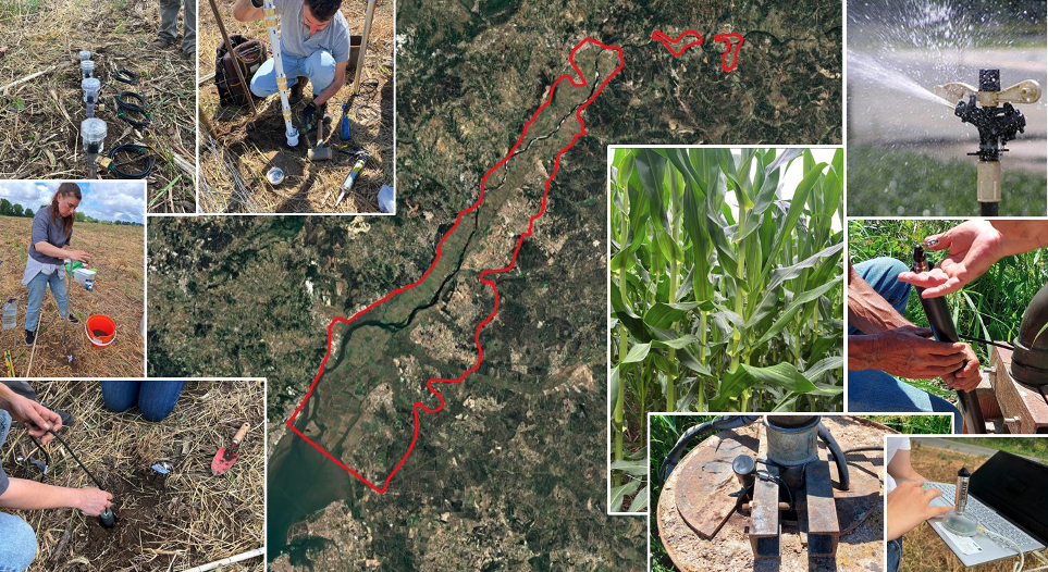
Located in the centre of Portugal, the Tagus Alluvial Aquifer (Aluviões do Tejo) extends along the Tagus River valley, covering an area of approximately 1,200 km² and encompassing agricultural zones of high productive potential. This region illustrates how agricultural development, through intensive groundwater abstraction, can significantly alter the hydrological behaviour of an alluvial aquifer system.
The Tagus basin includes large floodplain zones with fertile soils that have historically supported irrigation agriculture. Since the mid-20th century, irrigation expansion, increasingly dependent on groundwater, has played a key role in sustaining agricultural production under Mediterranean climate conditions, characterised by marked summer droughts.
The Tagus Alluvial Aquifer is a shallow unconfined aquifer composed mainly of sand and gravel layers deposited by the river over time. These materials allow for high permeability and rapid hydraulic connection with the Tagus River and its tributaries. However, the intense abstraction of groundwater for irrigation, particularly during dry years, can alter the natural exchange between the river and the aquifer, leading to local drawdowns and a reduction in baseflow contributions to the river.
At the same time, agricultural intensification has affected groundwater quality. Excessive use of nitrogen fertilisers and, in some areas, inadequate irrigation management have contributed to nitrate contamination of the shallow aquifer. Although the situation has slightly improved in recent years, concentrations at several monitoring points still exceed the limits established by the Nitrates Directive. The coexistence of numerous wells and boreholes also raises the risk of hydraulic interconnection with deeper aquifers, which could facilitate the downward migration of contaminants.
The main challenge in this context is to ensure the sustainable management of groundwater resources in the Tagus Alluvial Aquifer, balancing water use for agriculture with the protection of water quality. Continuous monitoring, improved irrigation efficiency, and the adoption of good agricultural practices are essential to safeguard this strategic water resource in the face of increasing climate variability.

Satellite image of the Tagus River valley delineating the Tagus Alluvial Aquifer and monitoring sites, highlighting the link between groundwater resources, irrigation, and water quality assessment.


